National Parks of China
Overview
| Designation | US National Park |
| Location | Northern Colorado, USA |
| Latitude, longitude | 40.4, -105.7 Google Maps |
| Nearby sites | Mesa Verde National Park, Black Canyon of the Gunnison National Park, Great Sand Dunes National Park, Arches National Park |
| Highlights | High mountains |
| Top sights | Trail Ridge Road, Bear Lake |
| Wildlife | Mountain lions, bighorn sheep, elk, black bears |
| Area | 265,800 acres |
| Highest point | 14,259 ft |
| Nearby cities | Denver |
| Themes | Mountains, Snow mountains, Forests, Lakes, Streams, Glaciers |
About
Rocky Mountain National Park lies in the Rocky Mountains of Colorado, about 100 miles northwest of Denver. The Continental Divide runs through it. It covers 266,000 acres (over 1,000 km²). The highest peak, Longs Peak, rises to 14,259 ft.
The park has about 360 miles of trails, 150 lakes, 450 miles of streams, 60 peaks over 12,000 ft and several small glaciers.
A quarter of the park lies above the tree line.
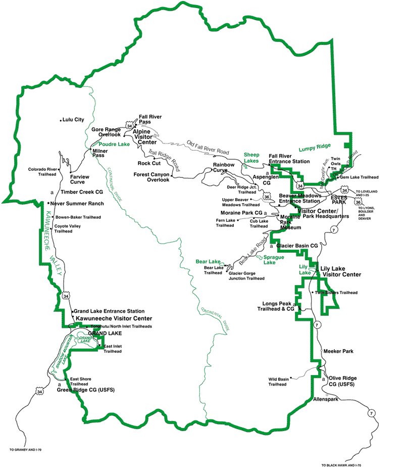
US 34, also called Trail Ridge Road, crosses the park and the mountains. Its highest point is 12,183 ft (3,713 m).
Travel information
Day trip: visit Bear Lake first, then take Trail Ridge Road (US 34) over the mountains to Grand Lake, or drive to Farview Curve and turn back.
Getting there: the park is about 100 miles northwest of Denver. From Denver, take I-25 north, then US 36 west. Free shuttle buses run in the park in summer.
Road conditions: the middle section of US 34 through the park is closed from mid-October to the end of May. Old Fall River Road is one-way and closed from October to the end of June.
Lodging: there are hotels in Estes Park, on the east side of the park, and in Grand Lake, on the west side.
Safety: the park is at high altitude. In the alpine zone, watch for altitude sickness and keep warm. Also beware of lightning, fast water, avalanches and wildlife.
Map