National Parks of China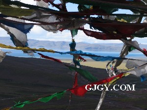
Overview
| Designation | National Park of China (seventh batch) |
| Province | Tibet |
| Location | Damxung and Baingoin counties, Nagqu, Tibet |
| Latitude, longitude | 30.7, 90.6 Google Maps |
| Highlights | The highest salt lake in the world; a sacred lake of Tibet; snow mountains |
| Top sights | Tashi Peninsula; the Nyainqêntanglha range |
| Area | 1,920 km² |
| Elevation | 4,718 m |
| Nearby cities | Lhasa, Gyantse |
| Nearby sites | The Potala Palace, Lhasa, Tanggula Mountains and the Source of the Nu River, Yarlung River |
| Themes | Lakes, Plateaus, Snow mountains, Islands, Buddhism, Springs, Hot springs & geothermal |
About
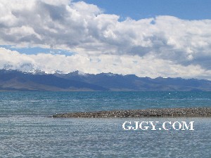
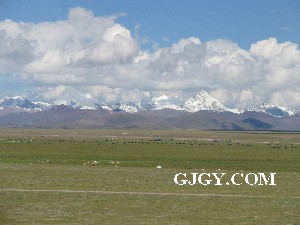
Namtso is one of the three sacred lakes of Tibet, between Damxung County of Lhasa and Baingoin County of Nagqu, at the northern foot of the Nyainqêntanglha range about 190 km north of Lhasa. North of it roll the plateau hills; to the south-east rises the range’s snow-capped main peak, 7,162 m. Namtso is the highest salt lake in the world and China’s second largest, over 70 km east to west and over 30 km north to south, more than 1,900 km², over 33 m deep, its water clear and sky-blue.
The Tashi Peninsula, also the Auspicious Love Island, is the largest peninsula and the main sight. Tashi (“auspicious”) Monastery still burns incense and sounds its drums and bells. The limestone peninsula, about 10 km², has been eroded by the lake into secluded caves and a karst landscape: shallow round mouths, long narrow tunnels, collapsed skylights, caves lined with knobbly stalactites, jagged rocks and peak forests everywhere with natural stone bridges between them. The lake has five islands, the largest, Liangduo, 1.2 km²; Buddhists say they are the incarnations of the Buddhas of the Five Directions.
Namtso is Tibetan for “heavenly lake”, Mongolian Tengri Nor. A famous holy place of Tibetan Buddhism, with Manasarovar and Yamdrok it is one of the three sacred lakes. Tradition makes it the seat of the tantric deity Chakrasamvara and one of the four “fierce” lakes. In the late 12th century Taklung Thangpa Tashi Pal, founder of the Taklung Kagyu school, and other masters practised tantra on the lake. The sacred mountain Kailash is for the Horse year, Namtso for the Sheep year and Tsari for the Monkey year: body, speech and mind. To circle the lake is to gain vast knowledge and merit, shed bad habits and suffering and reach enlightenment; in Sheep years the Buddhas, bodhisattvas and protectors gather at the lake, and one circuit with prayers then is worth 100,000 at other times, so monks and laity travel far to make it, peaking at the Saga Dawa festival in the fourth and fifth Tibetan months. Because the lake is so large and its shores so rough, a circuit takes 20 to 30 days, so most circle the Tashi Peninsula instead; seven circuits of the peninsula are said to equal one of the lake.
Namtso is a great lake formed by subsidence in the Himalayan orogeny at the end of the Tertiary and start of the Quaternary; as the plateau dried it shrank greatly, leaving three old shorelines, the highest about 80 m above the present lake.
It is fed by the Losa, Targu Zangbo and Chaha Sutai rivers. Around it stretch broad lakeside plains of sedges, mosses and edelweiss, rich natural pasture grazed all year. In early summer flocks of wild ducks come to breed; bears, wild yaks, wild asses and blue sheep live around it; the lake is full of scaleless and fine-scaled plateau fish, and the region yields caterpillar fungus, snow lotus and fritillary.
It is in the seventh batch of national parks of China (national scenic areas) named by the State Council in 2009.
Travel tips
Getting there: Namtso is about 190 km north of Lhasa, around four hours by road through Damxung. From Damxung the road crosses the Nagenla Pass at 5,190 m. Lhasa has an airport and a railway; buses run from Lhasa to Damxung, and the last leg to the lake is usually by chartered car. Entry to Tibet requires permits arranged in advance, and foreign visitors need an additional travel permit.
Plan: It can be done as a day trip from Lhasa, or you can stay a night in Damxung and continue.
Main sights: Tashi Peninsula is the lake's largest peninsula, with Tashi Monastery and limestone caves, and is the main destination. The lake is blue, with the snow peaks of the Nyainqentanglha range beyond.
Time: A day trip is possible but means nearly eight hours on the road. For a calmer visit, stay a night at the lake.
Season: The best months are roughly May to October. Winter is severe, and the pass often has snow and may be closed.
Where to stay: Tashi Peninsula has tent guesthouses that are simple and have few beds. Damxung town has more choice.
Altitude: The lake lies at 4,718 m. Spend three to five days acclimatising in Lhasa first, and do not go with a cold or heart or lung disease.
Caution: It is windy and cold at the lake, so bring warm clothes. In bad weather the pass may be snowed in and the track can bog down vehicles. Ask herders before photographing their animals.
Yangbajain
Yangbajain lies in Damxung County about 90 km north of Lhasa at the southern foot of the Nyainqêntanglha, near the Qinghai–Tibet highway, with hot springs, explosion springs and geysers, a geothermal power station and bathing pools. Over-developed, it is not much to look at; day tours from Lhasa to Namtso usually include it.
Getting there
Namtso is about 190 km north of Lhasa and about 60 km north-west of Damxung, which lies on the Qinghai–Tibet highway with plenty of traffic; from Damxung you must hire a car, crossing the 5,190 m Largen La pass. Day tours run from Lhasa. The Qinghai–Tibet railway, opened on 1 July 2006, has stations at Damxung and Yangbajain.
Where to stay
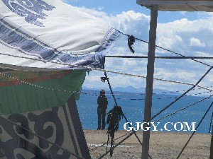
Tent guesthouses on the Tashi Peninsula are basic. There is no mains electricity and no running water; a generator may run briefly after dark. All the rooms together hold at most forty-odd people, so a crowd can mean trouble. Nights are very cold; dress warmly.
Tips
Acclimatise in Lhasa for 3 to 5 days first; many visitors underestimate the extra 1,100 m of altitude and nearly all get altitude sickness overnight by the lake. The wind is strong; wear more. Be sure to reach the Tashi Peninsula, not just the shore below Largen La. The pass is windy and cold even in the warmest season; in rain or snow do not go, as the pass may be deep in snow and the lakeside tracks bog vehicles. Photographing sheep or yaks near Yangbajain may bring a demand for payment from locals.
More photos