 National Parks of China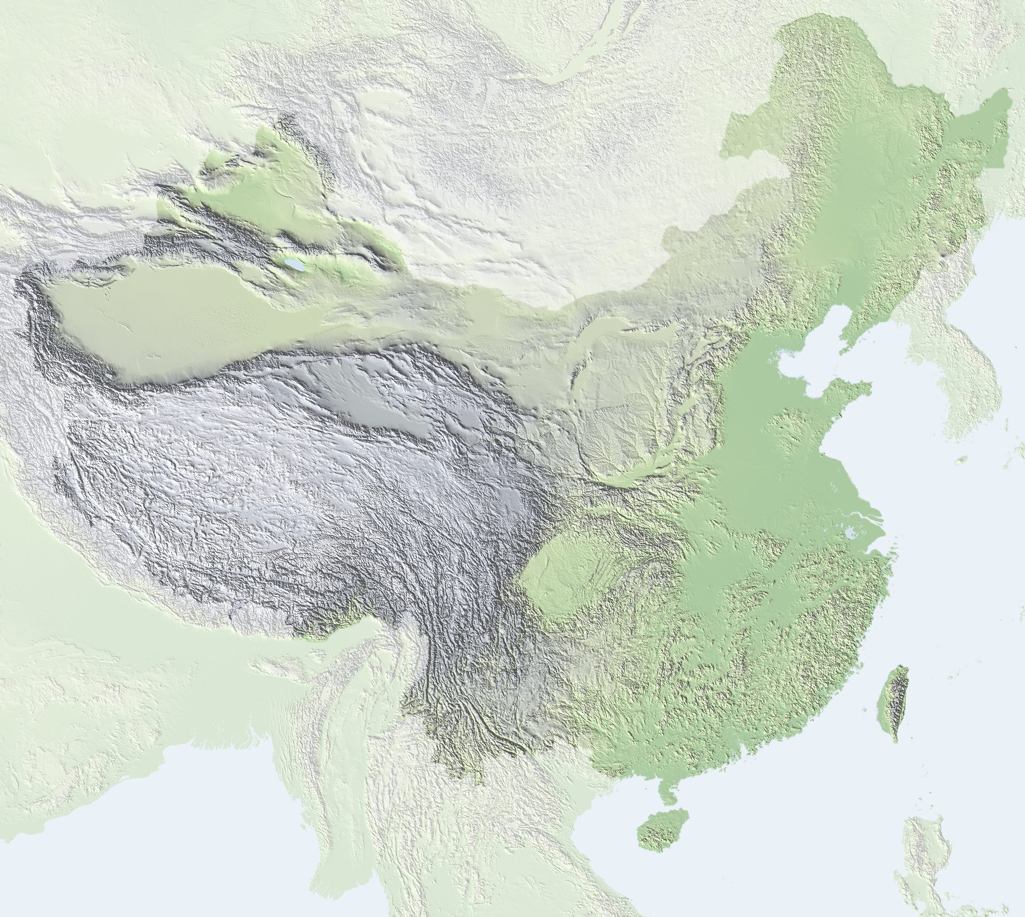
China falls from west to east in three broad steps: the Tibetan Plateau; the Inner Mongolian, Loess and Yunnan–Guizhou plateaus and the large basins; and the plains and hills of the east. The big ranges mostly run along the edges of these steps and around the plateaus and basins. The map labels the main ranges; red dots are parks on this site that belong to a range (click one to open its page). Click a range name, on the map or in the list below, to highlight it and its parks.
North-west
Altai Mountains (阿尔泰山)
In the far north of Xinjiang, the Altai trends north-west to south-east and carries forests and mountain pastures. Rivers such as the Irtysh rise here. Youyi Peak is 4,374 m high.
Tianshan Mountains (天山山脉)
Crossing central Xinjiang from west to east, the Tianshan extends about 1,700 km within China and separates the Tarim Basin to the south from the Junggar Basin to the north. It contains many intermontane basins, lakes and grasslands. Its highest peak is Tomur.
Parks on this site: Heavenly Lake of Tianshan, Tomur Grand Canyon
Helan Mountains (贺兰山)
Between Ningxia and Inner Mongolia and running north to south, the Helan shelters the Yinchuan Plain from the Tengger Desert to the west. Aobaogeda reaches 3,556 m.
Parks on this site: Western Xia Imperial Tombs
Altun Mountains (阿尔金山)
On the south-eastern edge of the Tarim Basin, the Altun Mountains run from north-east to south-west and link the Kunlun with the Qilian. The range is arid and forms a natural divide between Xinjiang and Qinghai–Gansu.
Qilian Mountains (祁连山)
On the north-eastern edge of the Tibetan Plateau between Qinghai and Gansu, the Qilian is made up of several parallel ridges running north-west to south-east. Glacial meltwater from the range feeds the oases of the Hexi Corridor. Tuanjie Peak, at 5,808 m, is among its highest.
Liupan Mountains (六盘山)
On the Ningxia–Gansu boundary and running north to south, the Liupan is a major range of the western Loess Plateau where tributaries of the Jing and Wei rivers rise. Migang Mountain is about 2,942 m.
Parks on this site: Mount Kongtong, Xumishan Grottoes
Tibetan Plateau
Karakoram (喀喇昆仑山脉)
Lying at the north-western end of the Tibetan Plateau and trending north-west to south-east, the Karakoram is heavily glaciated. K2 (Qogir), at 8,611 m, is the second highest peak in the world.
Kunlun Mountains (昆仑山脉)
Running from the eastern Pamirs to Qinghai and Sichuan, the Kunlun extends about 2,500 km and is one of the main mountain systems of western China. It separates the Tarim and Qaidam basins to the north from the interior of the Tibetan Plateau to the south. Kongur Tagh, at 7,649 m, is its highest peak.
Anyêmaqên Mountains (阿尼玛卿山)
In south-eastern Qinghai, with the Yellow River bending around it. Its highest peak, Maqên Gangri (about 6,282 m), is one of the sacred mountains of Tibetan Buddhism.
Bayan Har Mountains (巴颜喀拉山)
In south-central Qinghai and trending north-west to south-east, the Bayan Har divides the upper Yellow River from the upper Yangtze. Its ridges are broad and rounded, with modest relief.
Tanggula Mountains (唐古拉山)
Between Qinghai and Tibet, the Tanggula is an important range of the central Tibetan Plateau and the source region of the Yangtze. Its highest peak, Geladaindong (6,621 m), is surrounded by the glaciers that feed the river.
Parks on this site: Tanggula Mountains and the Source of the Nu River
Gangdise Mountains (冈底斯山)
In southern Tibet and trending east to west, the Gangdise separates the inland drainage of northern Tibet from the Yarlung Zangbo basin to the south. Its highest peak is Lunpo Gangri (7,095 m); Mount Kailash (Gangrinboqê, 6,638 m) in the west is its best-known peak.
Parks on this site: Mount Kailash and Lake Manasarovar
Nyainqêntanglha Mountains (念青唐古拉山)
In central Tibet, south of Lake Namtso, the range trends north-east to south-west and is heavily glaciated. Its main peak, Nyainqêntanglha Peak, is 7,162 m high.
Himalaya (喜马拉雅山脉)
Along the southern edge of the Tibetan Plateau, the Himalaya arc roughly east to west. It is among the highest and youngest mountain ranges in the world and includes Mount Everest, at 8,848.86 m the highest peak on Earth. Climate and vegetation differ sharply between its two sides.
Parks on this site: Mount Qomolangma (Everest), Shishapangma
South-west
Min Mountains (岷山)
On the Sichuan–Gansu side, the Min Mountains run north to south and divide tributaries of the upper Yangtze and the Yellow River. Xuebaoding, the highest peak, is 5,588 m.
Parks on this site: Jiuzhaigou and Huanglong
Longmen Mountains (龙门山)
On the north-western rim of the Sichuan Basin and trending north-east to south-west, the Longmen forms the transition from the Tibetan Plateau to the basin and is cut by active faults. Jiuding Mountain is about 4,989 m.
Parks on this site: Mount Longmen, Mount Qingcheng and the Dujiangyan Irrigation System
Qionglai Mountains (邛崃山)
An eastern branch of the Hengduan system on the western edge of the Sichuan Basin, trending north-east to south-west. It forms the core of the giant panda habitat. Siguniang Mountain is 6,250 m high.
Parks on this site: Mount Siguniang and the Sichuan Giant Panda Sanctuaries, Xiling Snow Mountain
Shaluli Mountains (沙鲁里山)
In western Sichuan between the Jinsha and Yalong rivers, the Shaluli runs north to south. Queer Shan reaches 6,168 m.
Daxue Mountains (大雪山)
In western Sichuan between the Dadu and Yalong rivers, the Daxue range runs north to south. Its main peak, Gongga Shan (7,556 m), is the highest in Sichuan.
Parks on this site: Mount Gongga (Minya Konka)
Nu Mountains (怒山)
In north-western Yunnan between the Lancang (Mekong) and Nu (Salween) rivers, the range runs north to south. Kawagarbo in the Meili Snow Mountains, at 6,740 m, is the highest peak in Yunnan.
Daliang Mountains (大凉山)
In south-western Sichuan, within Liangshan Yi Autonomous Prefecture, the Daliang is a transitional range between the Sichuan Basin and the Yunnan–Guizhou Plateau, running roughly north to south.
Hengduan Mountains (横断山脉)
On the south-eastern edge of the Tibetan Plateau, covering western Sichuan, north-western Yunnan and eastern Tibet. Ridges and deep river valleys alternate in parallel from north to south; the Jinsha, Lancang (Mekong) and Nu (Salween) flow south side by side between them. Gongga Shan, at 7,556 m, is the highest peak.
Dalou Mountains (大娄山)
In northern Guizhou and southern Chongqing, the Dalou trends north-east to south-west and divides the Wu River from the Chishui and Qijiang. Fengchuiling on Jinfoshan reaches about 2,251 m.
Parks on this site: Mount Jinfo
Yunling Mountains (云岭)
In north-western Yunnan between the Jinsha and Lancang (Mekong) rivers, the Yunling runs north to south and ends in the Jade Dragon Snow Mountain.
Parks on this site: Jade Dragon Snow Mountain and Lijiang
Gaoligong Mountains (高黎贡山)
In western Yunnan on the west side of the Nu (Salween), the Gaoligong runs north to south. It has marked altitudinal climate zones and very high biodiversity.
Wumeng Mountains (乌蒙山)
In north-eastern Yunnan and western Guizhou, the Wumeng trends north-east to south-west and divides the Jinsha basin from the Beipan River. Jiucaiping, at about 2,900.6 m, is the highest point in Guizhou.
Miao Mountains (苗岭)
In south-central Guizhou and trending roughly east to west, the Miao Mountains divide the Yangtze and Pearl River systems. Leigong Mountain reaches about 2,178 m.
Parks on this site: Mount Doupeng and the Jian River, Duyun
Ailao Mountains (哀牢山)
In central and southern Yunnan, the Ailao Mountains run about 500 km from south of Dali south-east towards the Red River, which flows along their eastern side (as the Yuan River). They mark part of the boundary between the Yunnan–Guizhou Plateau and the Hengduan region, form a clear climatic divide, and keep large tracts of old-growth forest.
North and north-east
Lesser Khingan Range (小兴安岭)
In north-central Heilongjiang and trending north-west to south-east, the Lesser Khingan has gentle slopes and is one of China's important forest regions. Pingding Mountain is about 1,429 m.
Parks on this site: Dazhan River
Greater Khingan Range (大兴安岭)
In north-eastern Inner Mongolia and north-western Heilongjiang, the Greater Khingan trends north-east to south-west and separates the Inner Mongolian Plateau from the Northeast Plain, and forest from steppe. Huanggangliang reaches about 2,029 m.
Changbai Mountains (长白山)
In eastern Jilin and Liaoning, the Changbai trends north-east to south-west and is the source of the Songhua, Yalu and Tumen rivers. Its highest peak on the Chinese side, Baiyun Peak, is about 2,691 m, and the summit holds Heaven Lake.
Parks on this site: Heaven Lake of Changbai Mountain
Yin Mountains (阴山)
In central Inner Mongolia and running east to west, the Yin Mountains separate the Inner Mongolian Plateau from the Hetao Plain and mark roughly the northern limit of the monsoon's influence.
Yanshan Mountains (燕山)
North of the North China Plain, across northern Beijing, Tianjin and Hebei, the Yanshan runs roughly east to west and much of the Great Wall follows its ridges. Wuling Mountain reaches about 2,118 m.
Parks on this site: Badaling & Thirteen Tombs of the Ming Dynasty, Mount Pan
Taihang Mountains (太行山)
Between Shanxi and Hebei, the Taihang extends from the hills west of Beijing south to the Yellow River, trending north-east to south-west. It marks the edge between the Loess Plateau and the North China Plain; the eastern flank is steep and cut by gorges. Xiaowutai Mountain reaches 2,882 m.
Parks on this site: Zhangshiyan, Taihang Grand Canyon, Wahuang Palace, Xiangtangshan Grottoes, White Cloud Cave, Mount Kong, Mount Cangyan, Xibaipo and Mount Tiangui, Mount Linlü, Qingtian River, Mount Shennong, Mount Wangwu and Mount Yuntai, Yesanpo, Shidu, Stone Flower Cave
Lüliang Mountains (吕梁山)
In western Shanxi between the Yellow River and the Fen River, the Lüliang trends north-east to south-west. Its main peak, Xiaowen Mountain in the Guandi range, is about 2,831 m.
Parks on this site: Mount North Wudang
Taiyi Mountains (泰沂山脉)
Crossing central Shandong roughly from west to east, from Mount Tai between Tai'an and Jinan through Mount Lu to Mount Yi, the Taiyi Mountains form the backbone of the central and southern Shandong uplands. They are not high, but rise sharply from the eastern edge of the North China Plain. The highest point is the Jade Emperor Peak of Mount Tai, which heads the Five Great Mountains; emperors performed the feng and shan sacrifices there, and it holds the highest place among China's sacred mountains.
Parks on this site: Mount Tai (Taishan), Boshan
Central China
Qinling Mountains (秦岭)
Crossing southern Shaanxi roughly from west to east, the Qinling is a major divide between northern and southern China: the Yellow River basin lies to the north and the Yangtze basin to the south, and the warm-temperate zone gives way to the subtropical. Mount Taibai, at 3,771.2 m, is the highest peak in eastern mainland China.
Parks on this site: Mount Hua, Mount Taibai, Mount Tiantai, Baoji, Terracotta Army and Mount Li, Lintong, Mount Shiren (Stone Men)
Daba Mountains (大巴山)
Where Shaanxi, Sichuan, Chongqing and Hubei meet, the Daba trends north-west to south-east, with Shennongjia at its eastern end. It divides the Han River from the Jialing and other Yangtze tributaries. Shennongding is 3,106.2 m.
Parks on this site: Shennongjia, Mount Guangwu and the Nuoshui River, Micang Mountain Grand Canyon
Dabie Mountains (大别山)
Where Henan, Hubei and Anhui meet, the Dabie runs north-west to south-east and divides the Huai River basin from the Yangtze. Baimajian rises to about 1,777 m.
Parks on this site: Mount Tianzhu, Mount Jigong, Mount Tongbai and the Source of the Huai
Wu Mountains (巫山)
In eastern Chongqing and western Hubei, the Wu Mountains trend north-east to south-west and the Wu Gorge of the Three Gorges cuts through them.
Wuling Mountains (武陵山)
Where Hunan, Hubei, Chongqing and Guizhou meet, the Wuling trends north-east to south-west and divides the Wu River from the Yuan. Its main peak, Fenghuang Mountain in Fanjingshan, is about 2,570 m.
Parks on this site: Wulingyuan (Zhangjiajie), Fanjingshan, Dehang, Fenghuang Ancient Town, Liye and Wulong Mountain, Mengdong River
Xuefeng Mountains (雪峰山)
In west-central Hunan between the Yuan and Zi rivers, the Xuefeng trends north-east to south-west. Subaoding reaches about 1,934 m.
Parks on this site: Mount Huxing and the Huayao, Ziquejie Terraces and the Meishan Dragon Palace
East and south
Xianxia Mountains (仙霞岭)
In south-western Zhejiang on its borders with Fujian and Jiangxi, the Xianxia Mountains trend north-east to south-west and form part of the divide between the Qiantang river system and the Min and Ou rivers. The Xianxia Pass was long the main route between Zhejiang and Fujian. The three great rocks of Mount Jianglang stand on the northern side of the range.
Parks on this site: Mount Jianglang
Luoxiao Mountains (罗霄山脉)
On the Hunan–Jiangxi boundary and running north-north-east, the Luoxiao divides the Xiang River from the Gan River; Jinggangshan lies in its middle section. Nanfengmian reaches about 2,120 m.
Parks on this site: Jinggangshan, Mount Wugong
Wuyi Mountains (武夷山)
On the Fujian–Jiangxi boundary and trending north-east to south-west, the Wuyi divides the Min River basin from the Gan River basin. Huanggang Mountain, at 2,157.8 m, is the highest peak in south-eastern mainland China.
Parks on this site: Mount Wuyi
Central Fujian Ranges (闽中山带)
Running through central Fujian from north-east to south-west, parallel to the Wuyi range to the west, this belt is made up of the Jiufeng Mountains in the north, the Daiyun Mountains in the middle and the Boping Ridge in the south. It separates the mountains of north-western Fujian from the coastal hills and plains, and rivers such as the Min and Jiulong cut through it to the sea. Mount Daiyun, the highest peak, is about 1,856 m.
Parks on this site: Jiulongji Waterfalls
Nanling Mountains (南岭)
Between Hunan and Jiangxi to the north and Guangdong and Guangxi to the south, the Nanling runs roughly east to west and is made up of the Yuecheng, Dupang, Mengzhu, Qitian and Dayu ranges. It divides the Yangtze basin from the Pearl River basin. Maoer Mountain reaches about 2,141.5 m.
Parks on this site: Nanshan, Jiuyi Mountain and Mausoleum of Emperor Shun
Shiwandashan (十万大山)
In southern Guangxi, trending north-east to south-west, Shiwandashan is a wet, densely forested range.
Other famous mountains and gorges
The map also marks famous mountains that do not belong to the ranges above, and the Three Gorges where the Yangtze cuts through the Wu Mountains: Mount Lao, Qingdao, Mount Mogan, The Three Gorges of the Yangtze, Mount Heng (Northern Sacred Mountain), Mount Heng (Southern Sacred Mountain), Mount Song, Huangshan (Yellow Mountains), Mount Wutai, Mount Emei and the Leshan Giant Buddha, Mount Jiuhua, Mount Putuo, Mount Wudang, Mount Longhu (Dragon and Tiger Mountain), Mount Qiyun, Mount Lu (Lushan), Mount Sanqing.