National Parks of China
Overview
| Designation | National Park of China (fifth batch) |
| Province | Henan |
| Location | Southern Taihang Mountains west of Linzhou, Anyang, Henan |
| Mountains | Taihang Mountains |
| Latitude, longitude | 36.1, 113.7 Google Maps |
| Top sights | The Taihang Grand Canyon, the Red Flag Canal |
| Highest point | 1,675 m |
| Nearby cities | Henan, Hebei, Shanxi, Taiyuan, Zhengzhou, Shijiazhuang |
| Nearby sites | Mount Wangwu and Mount Yuntai, Mount Song, Longmen Grottoes, Luoyang, Taihang Grand Canyon, Yin Xu, Anyang |
| Themes | Mountain, Canyon, Stamp, Culture |
About
The Mount Linlü scenic area lies in the southern Taihang west of Linzhou, Anyang, Henan; the highest point is 1,675 m. Its sights are the Red Flag Canal, the “man-made river in the sky”, the Taihang Grand Canyon, Wangxiang Rock, Peach Blossom Valley and Tianping Mountain. The canyon is 30 km long and 200 m wide, 60 m at its narrowest.
It is in the fifth batch of national parks of China (national scenic areas) named by the State Council in 2004.
Travel tips
Getting there: the park is in the west of Linzhou, Henan, on the eastern foot of the Taihang Mountains. The nearest large city is Anyang, where Anyang East station has high-speed trains, and coaches from Anyang to Linzhou take about an hour. Handan and Xinxiang also offer connections.
Layout: the main sights are the Red Flag Canal, the Taihang Grand Canyon, Wangxiang Rock, Peach Blossom Valley and Tianping Mountain. They are some distance apart and are easiest to link by car.
Red Flag Canal: along the canal are relics such as the Youth Tunnel, the watershed and the Taoyuan aqueduct. You can walk part of the canal, and the Red Flag Canal memorial hall explains how it was built in the 1960s.
Taihang Grand Canyon: about 50 km long and 1.5 km wide. The park is made up of sections including Peach Blossom Valley and Black Dragon Pool, and can be walked or toured by park bus.
Time: half a day for the canal and a day for the canyon. Two days for both is relaxed.
Season: summer is cool in the mountains and the main season. Autumn colours are the best, and in winter some mountain paths freeze and may be closed.
Where to stay: Linzhou town is the most convenient, and there are farmhouse inns near the canyon and the canal.
Caution: there are many mountain roads. After summer storms flash floods and rockfalls occur, so keep out of gullies after rain.
The Red Flag Canal
The Red Flag Canal, about 1,500 km of main and branch canals in all, “the man-made river in the sky”, is the longest mountain irrigation system in the world. Begun in February 1960 and largely complete by July 1969, it was built under terrible hardship: each worker had only 0.5 kg of grain and 1.5 kg of vegetables a day. The work levelled 1,250 hilltops, cut 211 tunnels, built 151 aqueducts and 1,500 km of channel; the 70 km main canal is 4.3 m high and 8 m wide and carries 18.3 m³/s, dividing below the watershed into three trunk canals, with 338 small and medium reservoirs, over 250 pumping stations, 52 hydro stations and 12,408 structures along it.
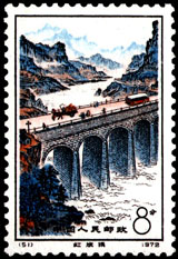
The Taoyuan Bridge on the canal is a seven-arch stone bridge carrying the canal beneath its roadway, for traffic and water alike.
Stamps
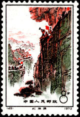
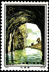
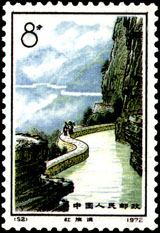
In 1972 China Post issued 49–52 “The Red Flag Canal”, four stamps: the Foolish Old Man moves the mountains, the Youth Tunnel, Taoyuan Bridge and the river in the sky.