 National Parks of China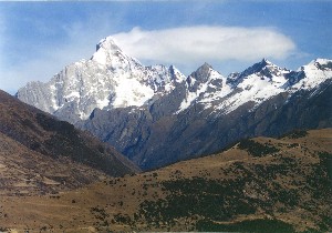
Overview
| Designation | UNESCO World Heritage (natural, 2006) National Park of China (third batch) |
| Province | Sichuan |
| Location | Between Xiaojin and Wenchuan counties, Sichuan |
| Latitude, longitude | 31.2, 102.9 Google Maps |
| Highlights | Giant panda habitat; snow mountains |
| Top sights | Wolong Giant Panda Nature Reserve |
| Wildlife | Giant panda, red panda, golden snub-nosed monkey, snow leopard, clouded leopard, takin; dawn redwood, yew |
| Highest point | 6,240 m |
| Nearby cities | Chengdu, Chongqing, Lanzhou |
| Nearby sites | Mount Qingcheng and the Dujiangyan Irrigation System, Xiling Snow Mountain, Mount Emei and the Leshan Giant Buddha, Jiuzhaigou and Huanglong, Mount Longmen, Mount Tiantai, Qionglai, Mount Gongga (Minya Konka) |
| Themes | Mountains, Snow mountains, Animals, Forests, Museums |
About
Mount Siguniang (“Four Sisters”) stands between Xiaojin and Wenchuan counties north-west of Chengdu in the middle of the Qionglai range. Its four peaks are the Youngest Sister (6,240 m), the Third Sister (5,664 m), the Second Sister (5,454 m) and the Eldest Sister (5,355 m). The area is beautiful and varied, rich in wildlife, above all the giant panda, and in Tibetan and Qiang culture.
It is in the third batch of national parks of China (national scenic areas) named by the State Council in 1994.
Travel tips
Getting there: from Chengdu the road goes by Dujiangyan, Wolong and the Balang Mountain tunnel to Rilong (Siguniangshan town) in Xiaojin county, about half a day by road. Long-distance buses run from Chengdu to Rilong; you can also drive or hire a car.
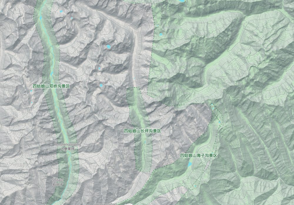
Shuangqiao Valley: the longest of the three valleys, seen mainly by sightseeing bus with stops for the snow peaks and river flats. One day is enough.
Changping Valley: a bus to the valley entrance, then a boardwalk with views of Yaomei Peak, the highest of the four. Going on to the Kushutan area takes most of a day there and back.
Haizi Valley: for hiking or riding on horseback. The route is long and high, suited to fit walkers; the larger lakes deep in the valley take a full day or more there and back.
Wolong: on the way to Siguniang, with a giant panda base where you can stop.
Time: two or three nights in Rilong for two or three of the valleys.
Season: autumn (late September to October) brings clear skies and autumn colours and the most visitors; winter has snow but is cold; summer is rainy, and landslides sometimes close the road.
Caution: Rilong is over 3,000 m and the valleys are higher. Walk slowly at first, keep warm and watch for altitude sickness. The sun is strong and nights are cold.
Sichuan Giant Panda Sanctuaries
The Sichuan Giant Panda Sanctuaries were inscribed on the World Heritage List as a natural site in July 2006. They cover Wolong, Mount Siguniang and the Jiajin Mountains, 9,245 km² in 12 counties of Chengdu, Ya’an, Aba Tibetan and Qiang Autonomous Prefecture and Garzê Tibetan Autonomous Prefecture.
Wolong Nature Reserve
The Wolong Giant Panda Nature Reserve lies at the eastern foot of Mount Siguniang, with breeding centres for the giant panda, red panda and golden snub-nosed monkey, the world-famous Wuyipeng field station for panda research, and a panda museum.
Chengdu to Wolong is about 3 hours by road. The road is a two-lane concrete highway in good condition.
Map
© OpenStreetMap contributors · terrain © Copernicus · Map credits