 Park of China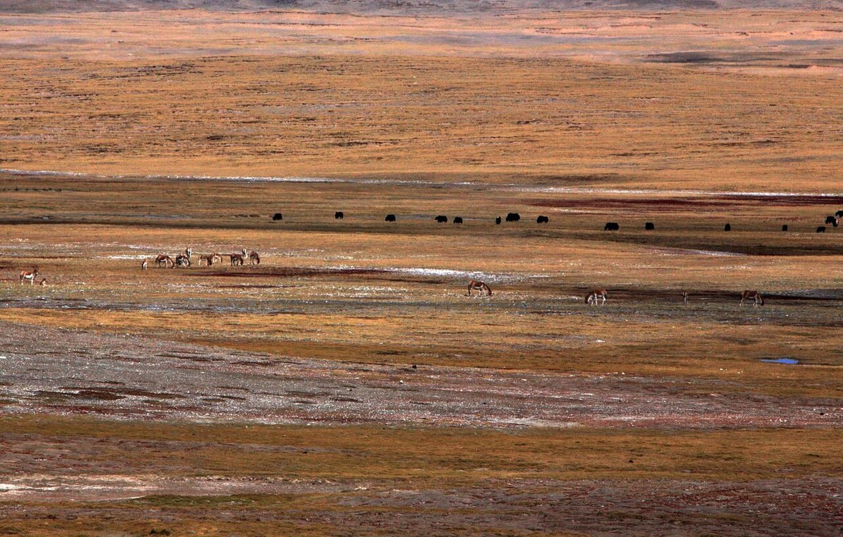
Overview
| Designation | National Park (new system) (established 2021) |
| Name | Sanjiangyuan National Park |
| Location | Southern Qinghai (Yushu and Golog prefectures and others) |
| Area | 190,700 km² |
| Managed by | National Forestry and Grassland Administration (National Park Administration) |
| Nearby cities | Xining |
| Nearby sites | Qinghai Hoh Xil 377km Search nearby |
| Latitude, longitude | 34.01, 96.21 Google Maps |
Introduction
Sanjiangyuan National Park lies in the heart of the Tibetan Plateau in southern Qinghai. It covers the source areas of the Yangtze, the Yellow River and the Lancang (Mekong), and is known as the “water tower of China”. Most of the park is above 4,500 m: alpine meadows, lakes, wetlands, glaciers and snow mountains, with Tibetan antelopes, wild yaks, kiangs and snow leopards.
A national park pilot began here in 2016 and the park was formally set up in 2021. It is the largest national park in China, divided into three areas at the sources of the Yangtze, the Yellow River and the Lancang; the Yangtze source area includes Hoh Xil.
According to the National Forestry and Grassland Administration (2026), the park sends about 80 billion m³ of water downstream each year, and Tibetan antelopes have recovered to over 70,000.
Park areas
The park runs from Huanghe Township in Madoi County in the east to the Changtang Plateau in the west, bounded by the Tanggula Mountains to the south and the eastern Kunlun Mountains to the north. The core protection zone covers 105,800 km² (55%), the general control zone 84,900 km².
Yangtze Source Area: Zhidoi and Qumarleb counties in Yushu Prefecture and the Tanggula Mountain Town area of Golmud, including Hoh Xil (Kekexili). The Geladaindong (the Yangtze's main source) and Dangqu areas were added when the park was formally established in 2021.
Yellow River Source Area: Madoi County, Golog Prefecture, centred on Gyaring Lake, Ngoring Lake and Xingxinghai. The Yueguzonglie source area was added in 2021.
Lancang (Mekong) Source Area: Zadoi County, Yushu Prefecture, including the Guozongmucha marshes and the Angsai gorges.
The park mainly covers 15 townships in five counties and cities of Qinghai (Zhidoi, Qumarleb, Zadoi, Madoi and Golmud), plus areas within Qinghai's administrative boundary north of the Tanggula Mountains that are administered in practice by the Tibet Autonomous Region; Amdo, Nyainrong and Baqen counties of Nagqu take part in managing them.
Nature and wildlife
The park lies in the transition from alpine meadow to alpine desert: meadow and steppe dominate the east, alpine desert covers Hoh Xil and the northern foot of the Tanggula Mountains, and the only sizeable forests, of Juniperus tibetica, grow in the Lancang source gorges.
Grassland covers 132,500 km², about 70% of the park; wetlands cover 31,700 km², notably the Xingxinghai, Guozongmucha and Dangqu marshes. Glaciers are concentrated on the north slope of the Tanggula, the Kunlun and the Bayan Har mountains.
The cold season lasts seven months; mean annual temperatures range from about -5.6 to 7.8°C, and annual precipitation rises from about 260 mm in the northwest to about 770 mm in the southeast. Air holds only 60–70% of sea-level oxygen.
According to the 2023 master plan, 832 species of wild seed plants are recorded, 11 of them under Class II state protection, such as Rhodiola tangutica and Saussurea medusa.
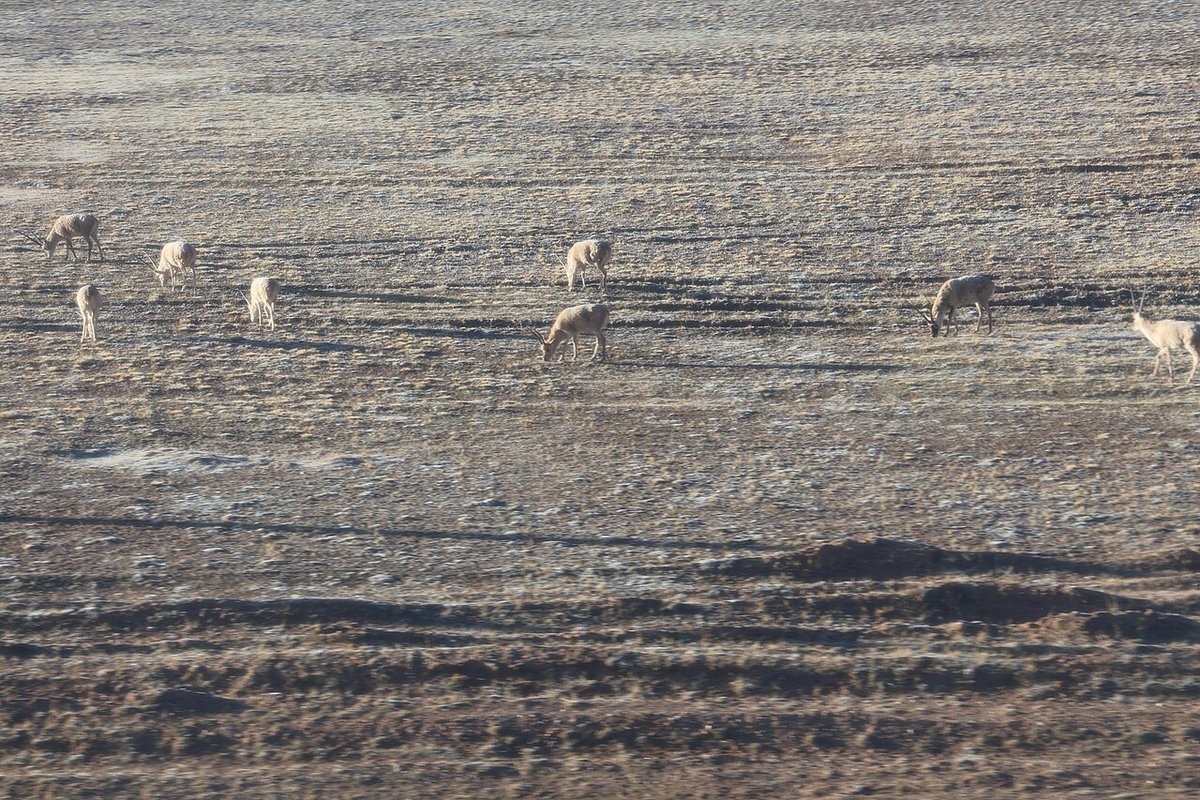
310 species of wild vertebrates are recorded, 24 under Class I state protection, including snow leopard, Tibetan antelope (chiru), wild yak, kiang, white-lipped deer and black-necked crane, and 60 under Class II, such as Pallas's cat, blue sheep and upland buzzard.
Angsai has one of the highest snow leopard densities; Hoh Xil is the chiru's main calving ground, with herds of females migrating to the Zhuonai Lake area every summer.
For the rivers and lakes of the region see Rivers and lakes of China.
Places to visit
Sonam Dargye Protection Station: beside the Qinghai–Tibet Highway (G109), the first anti-poaching station in Hoh Xil, with a chiru rescue centre open to visitors.
Kunlun Pass: where the Qinghai–Tibet Highway crosses the Kunlun Mountains, on the park's northern edge, with a memorial to Jiesang Sonam Dargye and views south over Hoh Xil.
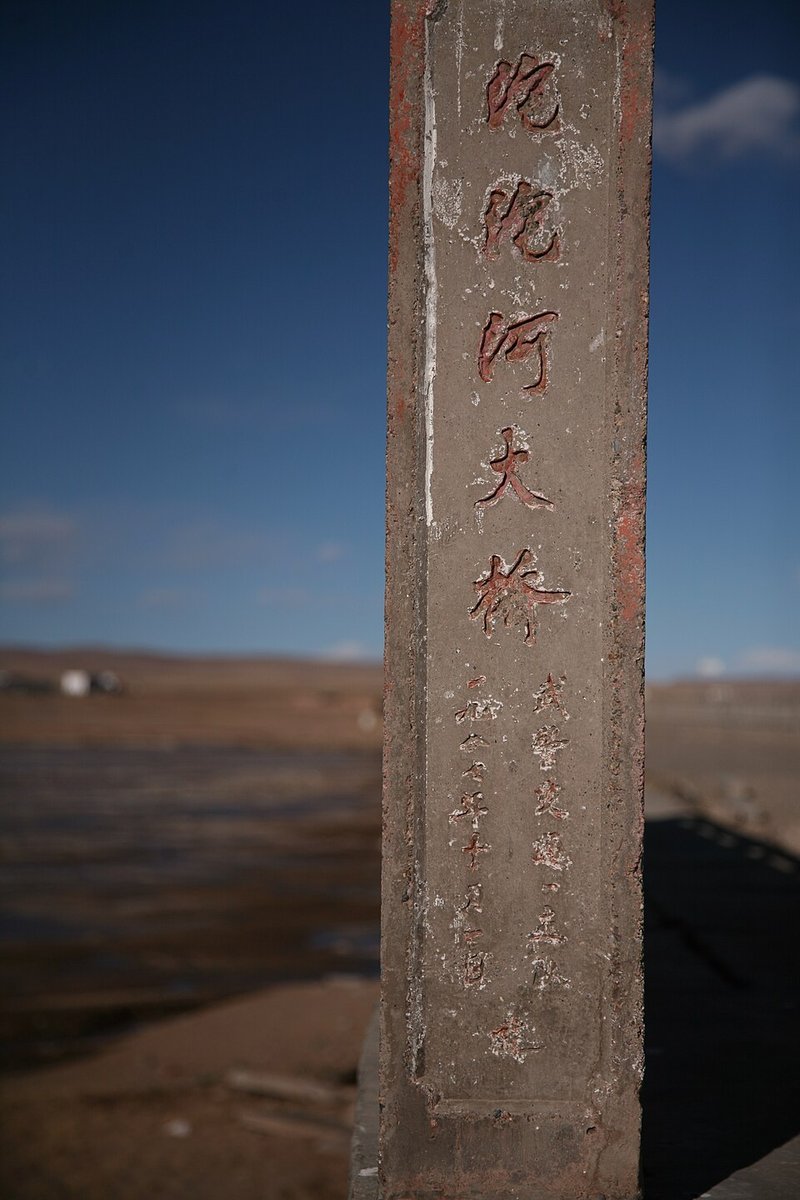
Tuotuo River: where the highway and the Qinghai–Tibet Railway cross the Tuotuo, the Yangtze's main headwater, near Tanggula Mountain Town; the braided river valley is visible from the road.
Gyaring Lake, Ngoring Lake and the Yak Head Monument: the two largest freshwater lakes on the upper Yellow River, with the Yellow River source monument on the hill between them; reachable by road from Madoi town.
Xingxinghai: a cluster of lakes and marshes near Madoi town beside the G214 highway, with many waterbirds in summer.
Angsai Grand Canyon: a Lancang gorge in Angsai Township, Zadoi County, with juniper forest and snow leopards; nature tours are run by local herders under a concession, must be booked in advance and are limited in number.
Travel tips
Hoh Xil and the Yangtze source: reached via the Qinghai–Tibet Highway (G109) or Railway; the nearest city and airport are in Golmud.
Yellow River source: take the expressway from Xining via Gonghe and Huashixia to Madoi, then on to Gyaring and Ngoring lakes; Golog Maqin Airport is the nearest airport.
Lancang source: head west from Yushu (Yushu Batang Airport) to Zadoi town, then on to Angsai.
June to September is the best time: green grassland, more wildlife, easier roads. Winters are severe and snowstorms often close roads. Chiru migrate to calve in summer.
Most of the park is above 4,000 m. Spend a day or two acclimatising in Xining, Golmud or Yushu, avoid exertion, and bring warm clothing and oxygen.
Entering the core protection zone without permission is prohibited. Do not cross the uninhabited Hoh Xil on your own or drive off-road; do not chase or feed wildlife, and stop for chiru crossing the road.
More photos
Map

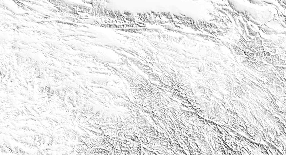
Photo credits: Tibetan wild asses and wild yaks on the plateau: leej1118bj (CC BY 3.0, Wikimedia Commons); Male Tibetan antelopes: Schwalbe (CC BY 4.0, Wikimedia Commons); A pillar of the Tuotuo River Bridge, with the Tuotuo, the main source of the Yangtze, behind: luxiaoxue (CC BY 3.0, Wikimedia Commons)
Nearby
| World Heritage | Qinghai Hoh Xil 377km |
| National parks of China | Daxiong Maoguojia Park 750km |
| National parks | Qinghai Lake 477km, Tanggula Mountains and the Source of the Nu River 484km |
| Historical sites | Gongsa Monastery Former Site and Tsongkhapa Hall 31km, Yushu Ancient Tombs 50km |
| National geoparks | Geer Mukun Lunshan National Geopark 287km |
| Nature reserves | Longbao National Nature Reserve 85km, Sanjiangyuan National Nature Reserve 147km, Changsha Gongma National Nature Reserve 183km, Keke Xili National Nature Reserve 300km |
| Historic villages | Laze Village 72km |