 Park of China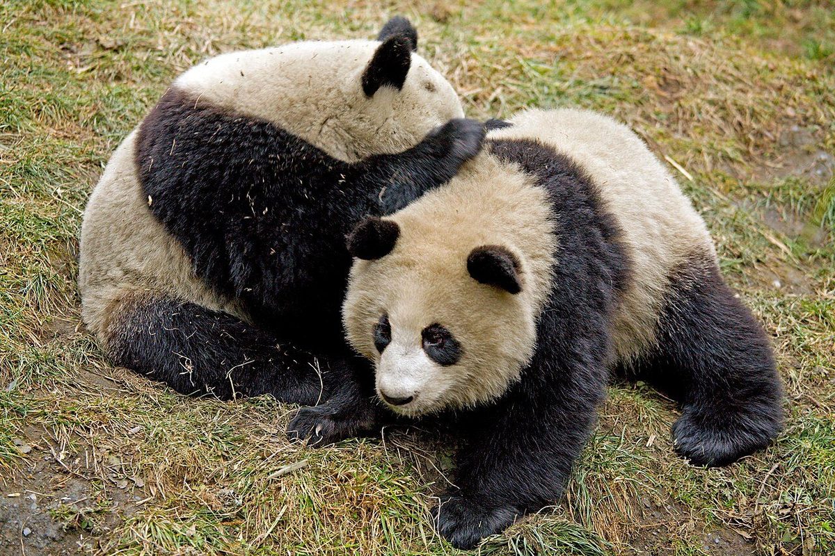
Overview
| Designation | National Park (new system) (established 2021) |
| Name | Giant Panda National Park |
| Location | Mountains where Sichuan, Shaanxi and Gansu meet |
| Area | 22,000 km² |
| Managed by | National Forestry and Grassland Administration (National Park Administration) |
| Nearby cities | Chengdu |
| Nearby sites | Mount Qingcheng 20km, Xiling Snow Mountain 26km, Dujiangyan Irrigation System 32km, Mount Emei 153km, Leshan Giant Buddha 157km Search nearby |
| Latitude, longitude | 30.90, 103.30 Google Maps |
Introduction
Giant Panda National Park protects wild giant pandas and their habitat. It spans Sichuan, Shaanxi and Gansu and is made up of the Min Mountains, Qionglai–Daxiangling, Xiaoxiangling, Baishuijiang and Qinling areas; most of it is in Sichuan.
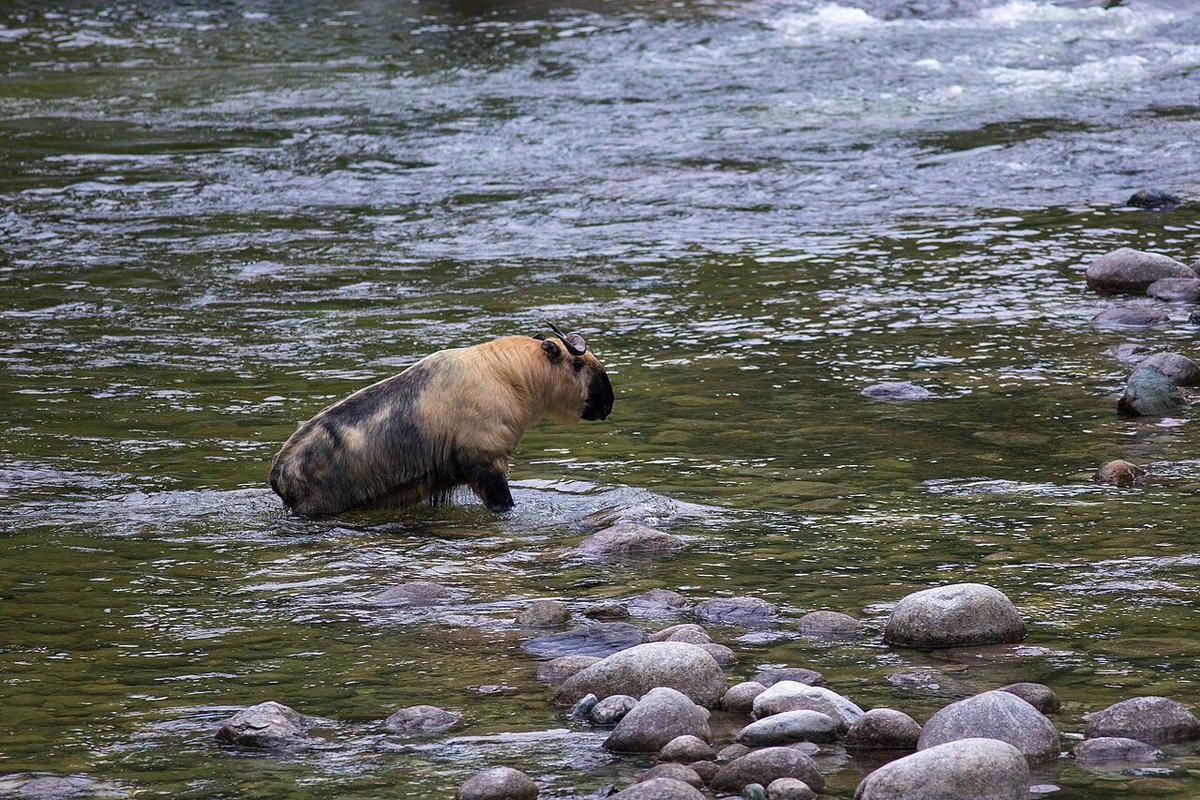
A national park pilot began in 2017 and the park was formally set up in 2021. At that time it held about 1,340 wild giant pandas, over 70% of China’s wild population. Golden snub-nosed monkeys, takins and snow leopards also live here.
According to the National Forestry and Grassland Administration (2026), ecological corridors now connect 13 local populations of wild giant pandas.
The map dot marks one place in the park, not its extent.
Park areas
The Sichuan part covers about 19,300 km², nearly 88% of the park, spanning 7 prefecture-level divisions and 20 counties (Sichuan Forestry and Grassland Bureau, 2024).
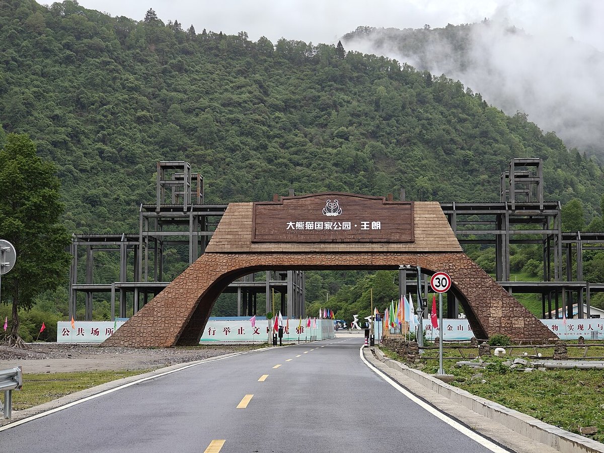
The Minshan area in northern Sichuan includes Wanglang in Pingwu County (Mianyang) and Tangjiahe in Qingchuan County (Guangyuan).
The Qionglai–Daxiangling area includes Wolong in Wenchuan County (Aba), Fengtongzhai in Baoxing County, Labahe in Tianquan County, Longcanggou in Yingjing County (all Ya'an) and Hongya County (Meishan). Its Chengdu section, about 1,445 km², is run by a Chengdu branch office.
The Gansu part lies in the Baishui River valley of Wen County, Longnan, under the park's Gansu administration; the Shaanxi part is on the southern slopes of the Qinling Mountains.
The park merged 73 protected areas in the three provinces and has built 6 ecological corridors (Xinhua, 2026).
Nature and wildlife
The park lies on the eastern edge of the Qinghai–Tibet Plateau, with deep valleys rising from lowland forest to alpine scree above the tree line.
Pandas mostly use bamboo forest below 3,500 m; in 2026 a camera trap on scree at 4,120 m in Fengtongzhai also recorded one.
The Sichuan part holds 13,900 km² of panda habitat and 1,227 wild pandas (Sichuan Forestry and Grassland Bureau, 2024).
China's wild panda population has grown from about 1,100 in the 1980s to about 1,900 (National Forestry and Grassland Administration, 2026).
Other rare species sharing the habitat include Tibetan macaques, Eurasian otters, the dove tree and Chinese yew.
Places to visit
Shenshuping Base, Wolong: a base of the China Conservation and Research Center for the Giant Panda in Gengda Town, Wenchuan County, with captive pandas, a visitor center and an education center.
Dengchigou: in Fengtongzhai, Baoxing County, where the French missionary Armand David obtained the type specimen of the giant panda in 1869; its Catholic church dates from 1839.
Labahe: a national AAAA scenic area below Mt. Erlang in Tianquan County, part of the panda habitat; autumn colors from mid-October.
Tangjiahe: in Qingchuan County; takin and golden snub-nosed monkeys are often seen in the low valleys; has a natural history museum.
Wanglang: in Pingwu County, with a history exhibition hall and nature-education trails.
Wannian Village, Longcanggou: the southern gateway community in Yingjing County, with a Giant Panda National Park exhibition hall.
Travel tips
Chengdu is the main gateway, with Shuangliu and Tianfu airports. Wolong is reached via Dujiangyan; Ya'an sites by the Chengdu–Ya'an railway to Ya'an, then by road; Tangjiahe via Guangyuan; Wanglang via Mianyang.
April to October is best: rhododendrons in spring, cool summers, autumn colors from late October. In winter, high mountain roads are often icy.
Core protection zones are closed to the public; nature-education and eco-experience activities require advance booking.
Do not feed or chase wildlife. Summer rains bring rockfall and debris-flow risk; watch for altitude sickness on high passes such as Balang Shan.
More photos
Map


Photo credits: A giant panda at Wolong: Chi King (CC BY 2.0, Wikimedia Commons); A takin wading across a river: Jean-Marie Hullot (CC BY 2.0, Wikimedia Commons); The Wanglang entrance of Giant Panda National Park: Sun Jiao (Interaccoonale) (CC BY 4.0, Wikimedia Commons)
Nearby
| World Heritage | Mount Qingcheng 20km, Xiling Snow Mountain 26km, Dujiangyan Irrigation System 32km, Mount Siguniang and the Sichuan Giant Panda Sanctuaries 51km |
| National parks | Mount Longmen 72km, Mount Gongga (Minya Konka) 200km, Jiuzhaigou–Huanglong Scenic Area 237km |
| AAAAA attractions | Anren Ancient Town Scenic Area 52km, Wenchuan Special Tourist Area 70km, Bifengxia Scenic Area 96km, Beichuan Qiang City Tourist Area 151km |
| AAAA attractions | Jiezi Ancient Town 26km, Yuantong Ancient Town 36km, Bamboo Art Village 38km, Hongkou Tourist Scenic Area 41km |
| Historic cities | Chengdu 78km |
| Cities | Chengdu 80km |
| Historical sites | Qingcheng Mountain Historic Building Complex 25km, Yutang Kiln Site 28km |
| Nature reserves | Wolong National Nature Reserve 23km, Fengtongzhai National Nature Reserve 55km, Qianfoshan National Nature Reserve 128km |
| Historic towns | Yuantong Town 36km, Xinchang Town 43km |