 National Parks of China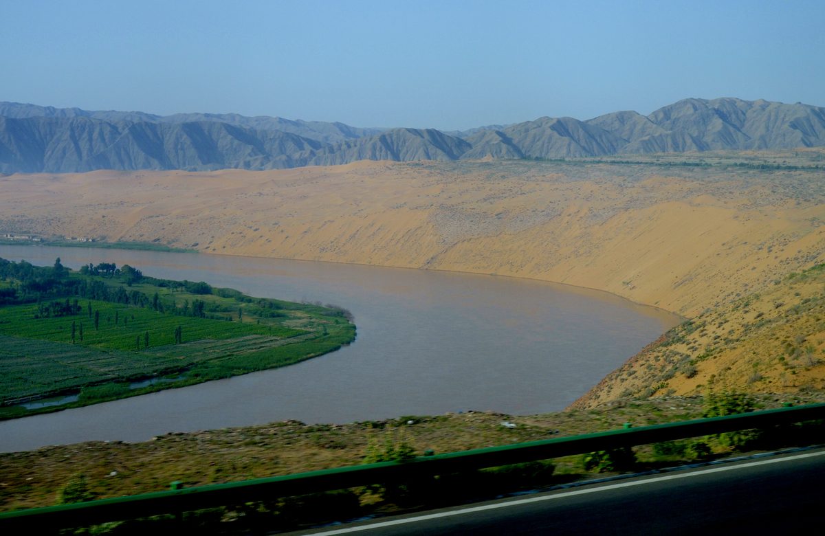
Overview
| Province | Ningxia |
| Latitude, longitude | 37.46, 104.99 Google Maps |
| Themes | Desert, Sand Dune, Long River, Rafting & boat trips, Cable Car |
About
Shapotou lies on the south-eastern edge of the Tengger Desert in Ningxia, where the Yellow River bends to the east and a high sand slope drops straight to its north bank. Sliding down the slope makes the sand boom, a sound once listed among the local sights as the “Bell of the Sand Slope”.
When the Baotou–Lanzhou Railway was built in the 1950s it had to cross the shifting dunes here. The sand was fixed with checkerboards of straw pressed into the surface and then planted with drought-tolerant shrubs, and the method was later used across China. The Shapotou National Nature Reserve protects this desert and its planted vegetation.
Travel tips
Getting there: Zhongwei has a railway station and an airport; the scenic area is about half an hour by road from the city.
What to do: the area is divided into a desert zone and a river zone, linked by a cable car. Slide down the sand or ride a camel in the desert, and float down the Yellow River on a sheepskin raft.
Season: spring and autumn are best; the sand is very hot at midday in summer, and winter winds are cold.
Time: one day.
Where to stay: in Zhongwei, or at desert camps and hotels near the scenic area.
Map
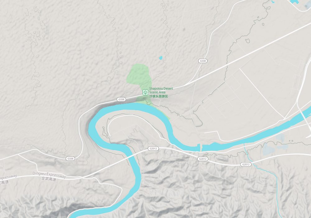
© OpenStreetMap contributors · terrain © Copernicus · Map credits
Photo credits: The Yellow River and the desert near Shapotou: mayanming (CC BY-SA 3.0, Wikimedia Commons)
Nearby
| World Heritage | Western Xia Imperial Tombs 139km, Bingling Temple 253km |
| AAAAA attractions | Yellow River Grand Canyon Tourist Area 98km, Zhenbeibu Western Film Studio 159km, Lingwu Shuidonggou Tourist Area 162km, Sand Lake (Shahu) 191km |
| AAAA attractions | Tengger Desert Wetland and Jinsha Island Tourism Area 12km, Tonghu Grassland 26km |
| Historical sites | Zhongwei Gao Temple 18km |